A “geographic information system” (GIS) is a computer-based tool that allows you to create, manipulate, analyze, store and display information based on its location. GIS makes it possible to integrate different kinds of geographic information, such as digital maps, aerial photographs, satellite images and global positioning system data (GPS), along with associated tabular database information (e.g., ‘attributes’ or characteristics about geographic features). Using GIS, you can incorporate all of this information into a single system and execute common database operations. For example, GIS allows you to perform statistical analysis or spatial queries, to explore ‘what-if’ scenarios, and to create predictive models.
Geophysical data and geographic information systems (GIS) are tightly connected to each other. Data arising through geophysical endeavors involve earth science, mining, archaeology, seismic, hydrological, energy exploration, geology, marine and engineering. Many different kinds of sensors can be used to capture this kind of data. That information supports the development of 2D, 3D and 4D techniques related to spatial analysis, visualization and display. A large amount of geophysical work today is related to understanding earth processes relating to geological hazards, earthquakes, volcanoes and flooding – all involving geological and ground survey information.
Applications:
Datum’s and coordinate systems
Geological hazard location
Planning and Resource Management
GIS for Utilities (Water Network, Sewer Network, Telecom & Electricity)
Modernization of Cadaster maps
Digital Mapping
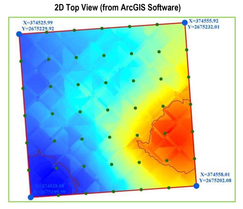
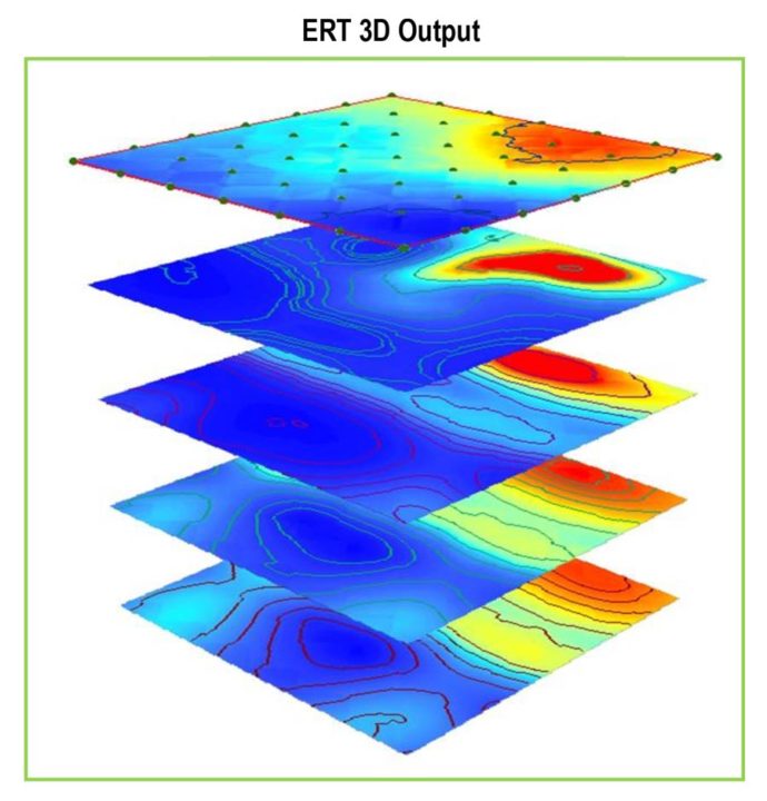
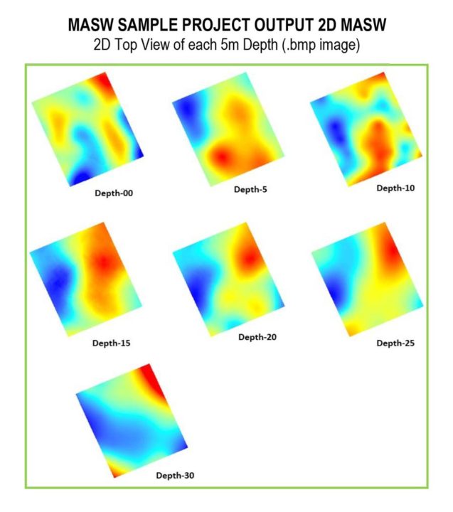
Geophysical data mapping

Data Processing Software Samples